
Suffolk County ZIP Code Directory Coverage
The Suffolk County ZIP polygon service and the county's official ZIP map provide the complete county-map label set below. The map was revised August 5, 2013 and warns that it is subject to revision and is not for surveying, conveyance, or precise purposes. Post-office names are postal associations, and several rows need address-level verification. The table preserves those cautions rather than converting a shared postal place into a town boundary.
| ZIP | Areas | Post office | Notes |
|---|---|---|---|
| 06390 | Fishers Island | Fishers Island | Connecticut-style ZIP on county map; verify address. |
| 11701 | Amityville | Amityville | County map label. |
| 11702 | Babylon | Babylon | County map label. |
| 11703 | North Babylon | North Babylon | County map label. |
| 11704 | West Babylon | West Babylon | County map label. |
| 11705 | Bayport | Bayport | County map label. |
| 11706 | Bay Shore | Bay Shore | County map label. |
| 11707 | North Lindenhurst | North Lindenhurst | County map label. |
| 11708 | North Babylon/West Babylon postal use | Verify USPS | Service type not confirmed by county map. |
| 11709 | Huntington Station postal use | Verify USPS | Verify exact address. |
| 11710 | North Amityville | North Amityville | County map label. |
| 11711 | Huntington Station postal area | Verify USPS | Added county-map label; verify exact address. |
| 11713 | Bellport | Bellport | County map label. |
| 11714 | Babylon/West Babylon postal use | Verify USPS | Verify exact address. |
| 11715 | Blue Point | Blue Point | County map label. |
| 11716 | Bohemia | Bohemia | County map label. |
| 11717 | Brentwood | Brentwood | County map label. |
| 11718 | Brightwaters | Brightwaters | County map label. |
| 11719 | East Islip | East Islip | County map label. |
| 11720 | Center Moriches | Center Moriches | County map label. |
| 11721 | Centerport | Centerport | County map label. |
| 11722 | Central Islip | Central Islip | County map label. |
| 11723 | Centerport/Huntington area | Verify USPS | Added county-map label; verify exact address. |
| 11724 | Cold Spring Harbor | Cold Spring Harbor | County map label. |
| 11725 | Commack | Commack | Overlapping town jurisdiction. |
| 11726 | Copiague | Copiague | County map label. |
| 11727 | Coram | Coram | County map label. |
| 11728 | Hauppauge/Smithtown postal geography | Verify USPS | Added county-map label; verify exact address. |
| 11729 | Deer Park | Deer Park | County map label. |
| 11730 | East Islip/Great River | Verify USPS | Verify exact place. |
| 11731 | Dix Hills | Dix Hills | County map label. |
| 11732 | East Northport | East Northport | County map label. |
| 11733 | East Setauket/Stony Brook | East Setauket/Stony Brook | Postal use shown on map. |
| 11734 | Farmingdale/East Farmingdale | Farmingdale | Postal line can differ from Babylon town. |
| 11735 | Farmingdale/Pinelawn | Verify USPS | Verify exact address. |
| 11736 | Great River | Great River | County map label. |
| 11737 | Hauppauge | Hauppauge | County map label. |
| 11738 | Holbrook | Holbrook | Town-overlap context. |
| 11739 | Islandia | Islandia | County map label. |
| 11740 | Kings Park | Kings Park | County map label. |
| 11741 | Lakeland | Lakeland | County map label. |
| 11742 | Holtsville | Holtsville | Town-overlap context. |
| 11743 | Huntington | Huntington | County map label. |
| 11744 | Melville/Huntington area | Verify USPS | Verify exact address. |
| 11745 | Huntington Station | Huntington Station | Added county-map label; verify exact address. |
| 11746 | Huntington Station | Huntington Station | County map label. |
| 11747 | Melville | Melville | County map label. |
| 11749 | Islandia/central postal use | Verify USPS | Verify exact address. |
| 11751 | Islip Terrace | Islip Terrace | County map label. |
| 11752 | Islip | Islip | County map label. |
| 11753 | Jericho map label | Verify USPS | Exact county coverage not safely transcribed. |
| 11754 | Kings Park/Smithtown area | Verify USPS | Verify exact address. |
| 11755 | Lake Ronkonkoma | Lake Ronkonkoma | Overlapping towns. |
| 11757 | Lindenhurst | Lindenhurst | County map label. |
| 11758 | Massapequa/edge | Verify USPS | Verify county boundary and address. |
| 11760 | Mount Sinai | Mount Sinai | County map label. |
| 11762 | Massapequa Park/edge | Verify USPS | Verify exact address. |
| 11763 | Medford | Medford | County map label. |
| 11764 | Miller Place | Miller Place | County map label. |
| 11765 | Miller Place/Rocky Point area | Verify USPS | Verify exact address. |
| 11766 | Nesconset | Nesconset | County map label. |
| 11767 | Northport | Northport | County map label. |
| 11768 | Northport/Centerport | Verify USPS | Verify exact address. |
| 11769 | Oakdale | Oakdale | County map label. |
| 11770 | Ocean Beach/Fire Island | Ocean Beach | Barrier-island service. |
| 11771 | Oyster Bay edge | Verify USPS | Verify county boundary and address. |
| 11772 | Patchogue | Patchogue | County map label. |
| 11773 | Smithtown | Smithtown | County map label. |
| 11774 | Northport | Northport | County map label. |
| 11775 | Melville/Huntington | Verify USPS | Verify exact address. |
| 11776 | Port Jefferson Station | Port Jefferson Station | County map label. |
| 11777 | Port Jefferson | Port Jefferson | County map label. |
| 11778 | Rocky Point | Rocky Point | County map label. |
| 11779 | Ronkonkoma | Ronkonkoma | Overlapping towns. |
| 11780 | Saint James | St. James | County map label. |
| 11782 | Sayville | Sayville | County map label. |
| 11783 | Seaford/edge | Verify USPS | Verify exact address. |
| 11784 | Setauket | Setauket | County map label. |
| 11786 | Shoreham | Shoreham | County map label. |
| 11787 | Smithtown | Smithtown | County map label. |
| 11788 | Hauppauge | Hauppauge | County complex area. |
| 11789 | Rocky Point/shore area | Verify USPS | Verify exact address. |
| 11790 | Stony Brook | Stony Brook | County map label. |
| 11791 | Syosset/edge | Verify USPS | Verify Nassau/Suffolk and address. |
| 11792 | Wading River | Wading River | Town-overlap context. |
| 11793 | West Sayville | West Sayville | County map label. |
| 11794 | Stony Brook | Stony Brook | Institutional status not verified. |
| 11795 | West Islip | West Islip | County map label. |
| 11796 | West Islip/Islip area | Verify USPS | Verify exact address. |
| 11797 | Woodbury/edge | Verify USPS | Verify exact address. |
| 11798 | Wyandanch | Wyandanch | County map label. |
| 11901 | Riverhead | Riverhead | County seat postal place. |
| 11930 | Amagansett | Amagansett | County map label. |
| 11931 | Amagansett/Montauk area | Verify USPS | Verify exact address. |
| 11932 | Bridgehampton | Bridgehampton | County map label. |
| 11933 | East Hampton | East Hampton | Postal place on county map. |
| 11934 | Center Moriches/Eastport area | Verify USPS | Verify exact address. |
| 11935 | Cutchogue | Cutchogue | County map label. |
| 11937 | East Hampton | East Hampton | County map label. |
| 11939 | East Marion | East Marion | County map label. |
| 11940 | East Quogue | East Quogue | County map label. |
| 11941 | Eastport | Eastport | County map label. |
| 11942 | East Quogue | East Quogue | Added county-map label; verify exact address. |
| 11944 | Greenport | Greenport | County map label. |
| 11946 | Hampton Bays | Hampton Bays | County map label. |
| 11947 | Hampton Bays/Southampton area | Verify USPS | Verify exact address. |
| 11948 | Laurel | Laurel | County map label. |
| 11949 | Jamesport | Jamesport | County map label. |
| 11950 | Medford/Shirley postal use | Verify USPS | Verify exact address. |
| 11951 | Manorville | Manorville | County map label. |
| 11952 | Mattituck | Mattituck | County map label. |
| 11953 | Middle Island | Middle Island | County map label. |
| 11954 | Montauk | Montauk | County map label. |
| 11955 | New Suffolk/Peconic area | Verify USPS | Verify exact address. |
| 11956 | New Suffolk | New Suffolk | County map label. |
| 11957 | Orient | Orient | County map label. |
| 11958 | Peconic | Peconic | County map label. |
| 11959 | Quogue | Quogue | County map label. |
| 11960 | Remsenburg | Remsenburg | County map label. |
| 11961 | Ridge/Shirley area | Verify USPS | Verify exact address. |
| 11962 | Sagaponack | Sagaponack | County map label. |
| 11963 | Sag Harbor | Sag Harbor | County map label. |
| 11964 | Shelter Island | Shelter Island | County map label. |
| 11965 | Shelter Island Heights | Shelter Island/Heights | County map label. |
| 11967 | Shirley | Shirley | County map label. |
| 11968 | Southampton | Southampton | County map label. |
| 11969 | Southampton/Water Mill area | Verify USPS | Verify exact address. |
| 11971 | Southold | Southold | County map label. |
| 11973 | Speonk | Speonk | County map label. |
| 11975 | Wainscott | Wainscott | Town-overlap context. |
| 11976 | Water Mill | Water Mill | County map label. |
| 11977 | Westhampton | Westhampton | County map label. |
| 11978 | Westhampton Beach | Westhampton Beach | County map label. |
| 11980 | Yaphank | Yaphank | County map label. |
The county map includes postal geography at the edge of Suffolk County and labels that require more than a broad place-name match. A missing certainty in the notes is deliberate. The research did not verify service type for every possible PO box or institutional label, so the table does not call one unique without address-level confirmation.
Map Suffolk County ZIP Code Geography
The ZIP layer is a geographic context tool. Its service describes area, post-office name, and population fields, while the parcel polygon layer adds ZIP Code, Full Address, Municipality, and the district-section-block-lot fields used for local records. The map can show a ZIP area or parcels inside its geography, but it does not create a roster of people. Use it to compare postal coverage with the municipality that controls the property record.
The Suffolk County GIS ZIP layer is the source for the captured map service.
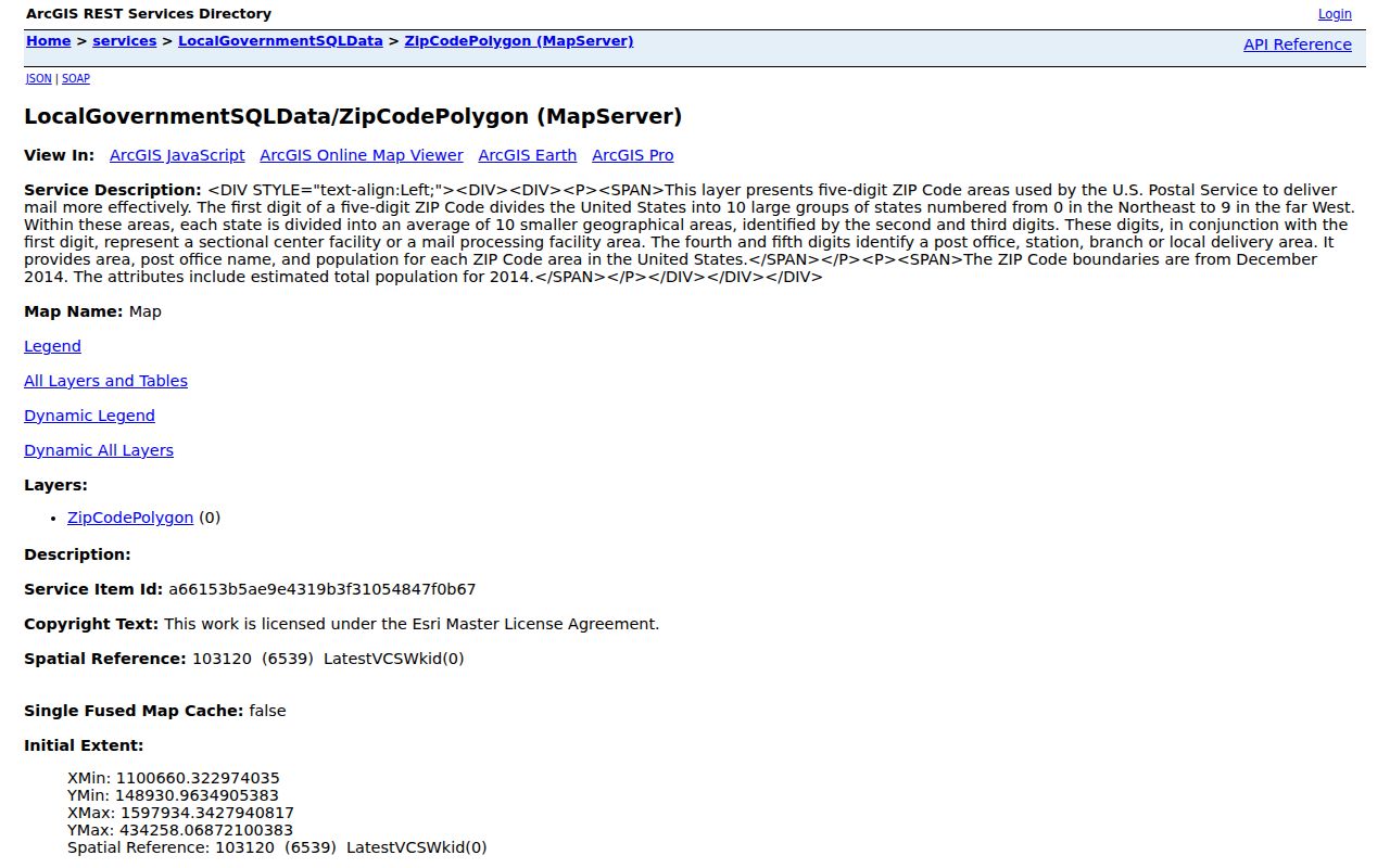
The layer helps place a postal code beside a parcel and municipal label. It should not be used as a survey, a town-boundary ruling, or a way to identify all individuals in an area.
Western Suffolk County ZIP Codes
Western and central Suffolk postal areas include the 117xx labels associated with Babylon, Huntington, Islip, Smithtown, Brookhaven communities, and edge areas near Nassau County. A single place name can conceal different town jurisdictions. Commack has Huntington and Smithtown context. Hauppauge has Islip and Smithtown context. Holbrook and Holtsville can touch Brookhaven and Islip, while Lake Ronkonkoma reaches Brookhaven, Islip, and Smithtown.
Use the ZIP code directory to narrow the postal area, then read the county GIS Municipality field before contacting an assessor or a permit office. The same check matters for Farmingdale, Massapequa, Seaford, Syosset, Woodbury, and Oyster Bay edge labels. Their appearance on the county map is not a finding that every address in a postal area lies in Suffolk County.
Eastern Suffolk County ZIP Codes
Eastern Suffolk is spread among Riverhead, North Fork, South Fork, Shelter Island, and barrier-island communities. The postal map places Riverhead at 11901, carries Fishers Island under 06390, and includes Ocean Beach on Fire Island under 11770. North Fork and South Fork names can be postal places, hamlets, incorporated villages, or town references. That layered geography makes a complete address more useful than a ZIP alone.
Riverhead can refer to a county seat, town, hamlet, post office, or library title. Wading River and Wainscott also have town-overlap context. In coastal and seasonal communities, a public association or local-history record may describe a place without determining the parcel's municipality. Pair the postal name with GIS and town fields before ordering a deed or asking for a local file.
Verify Suffolk County ZIP Codes
Use the USPS ZIP Lookup for a complete street address, city, and state when the goal is to confirm delivery ZIP. It can also list ZIPs for a city and state. USPS cautions that a displayed address does not guarantee the actual location of a business. Its result is therefore postal verification, not a ruling on the town, village, parcel, or property-record custodian.
A postal city and a municipality can differ. Record both the USPS result and the county GIS Municipality result. If they disagree, also retain the tax-map district, section, block, and lot. Those fields give the town assessor and Clerk Kiosk a stable reference even when a shared postal place crosses an administrative line.
Search Suffolk County by ZIP Code
A ZIP code can narrow an address investigation, but official systems use it in different ways. The Clerk resolver accepts ZIP with house number and street name to return candidate tax-map rows. The GIS viewer shows ZIP and municipality as parcel context. The state voter lookup accepts ZIP as part of an individual voter search, but it also requires a name, date of birth, county, and an enabled response check. It cannot list all registrants in a ZIP from the public form.
- Confirm the complete delivery address with USPS, especially where the county map gives a shared or edge note.
- Search the address in Suffolk GIS and record the ZIP, Municipality, Parcel ID, and district-section-block-lot.
- Enter the house number, street name, and ZIP in the Suffolk County Clerk Kiosk resolver, then select the matching tax-map row.
- Use the relevant town assessor for the assessment roll or property card, since Suffolk has ten assessment jurisdictions.
- When a ZIP has narrowed an address to a road, use the Suffolk County Street Directory for the tax-map and deed sequence.
For a person-centered voter check, the New York voter lookup is the appropriate official route only when its required identity fields are available. A ZIP filter is not evidence of occupancy and does not turn the service into a neighborhood directory.
Suffolk County ZIP Code Search Fields
The most useful ZIP-capable fields come from official address, parcel, Clerk, and voter services. A ZIP code directory search works best when a postal field is combined with a house number, street, parcel ID, or person-specific information. That pairing avoids treating a broad postal area as one homogeneous local record set.
| Service | ZIP-capable field | Other field or control | What it can do |
|---|---|---|---|
| Clerk address resolver | Zip Code, optional text | House Number, Street Name, Property Tax Map ID | Returns candidate tax-map rows; not a ZIP-wide owner search. |
| Suffolk GIS parcel layer | ZIP Code display field | Full Address, Municipality, Parcel ID, map click | Places a parcel in postal and municipal context. |
| GIS ZIP layer | ZIP polygon | Area, post-office name, population fields | Shows ZIP geography and per-area context. |
| NYS voter self-lookup | Zip Code text | County, last name, first name, date of birth, address, response check | Individual registration and polling search, not an area roster. |
| Town assessor | ZIP or address behavior varies | Owner name, situs address, SCTM, tax year | Confirm the local town's available fields and terms. |
The Clerk's broad result display is capped at 2,000 records. Narrow an address resolver search by street, house number, or exact tax map rather than interpreting a long results list as a ZIP-level directory.
Suffolk County ZIP Codes Cross Town Lines
Postal, municipal, and tax-district geography must be read together in Suffolk County. Commack, Eastport, Hauppauge, Holbrook, Holtsville, Lake Ronkonkoma, Riverhead, Wading River, and Wainscott are named overlap examples in the County Clerk district-code material. A ZIP or mailing city can be right for delivery while still leading to the wrong assessor, permit desk, or local clerk record.
This records geography reflects the county's mix of ten towns, incorporated villages, hamlets, North Fork and South Fork communities, and barrier-island settlements. The geographic names are useful search terms, especially for historical newspapers and library catalogs, but they need a town and parcel anchor when the question concerns a current property record.
Suffolk County ZIP Code Search Limits
ZIP-wide map results are geography, not a household list. Parcel data can identify a parcel owner point and address fields, while the town assessment record can identify an assessed owner and mailing field. Neither proves that a particular person is presently at the address. Voter registration has protected fields and statutory limits, and the public self-lookup does not return a neighborhood list.
Use records carefully. A Suffolk County ZIP code is a postal filter for lawful research, not permission to compile or use personal information to stalk, harass, intimidate, or harm anyone.
When a ZIP, town, and GIS result conflict, ask the appropriate custodian for the record that controls the question. The Town Assessor handles current assessment details, the County Clerk records land instruments, and USPS verifies delivery information. Note: Keep the ZIP check date because postal labels and local map layers can change over time.
Define Suffolk County ZIP Code Terms
Postal terms help describe delivery and sorting. They are useful in a Suffolk County ZIP code directory, but they do not replace the municipality, tax district, or legal parcel description used by local records offices.
- ZIP Code
- A postal delivery area used by USPS. It can cross town, village, hamlet, and county-edge geography.
- ZIP+4
- An added four-digit delivery segment that makes the postal address more specific. It does not define a parcel boundary.
- PO-box ZIP
- A ZIP used for post-office-box mail. The county map alone did not confirm service type for every special-use label.
- Unique ZIP
- A ZIP associated with one institution or organization. Do not assign that status unless USPS or another controlling source confirms it.
- Carrier route
- A postal delivery sequence within an area. It is not a municipal district or a complete list of people at addresses.